‘Tornado’ Touches Down near Pasco, Dust Devil on Steroids?
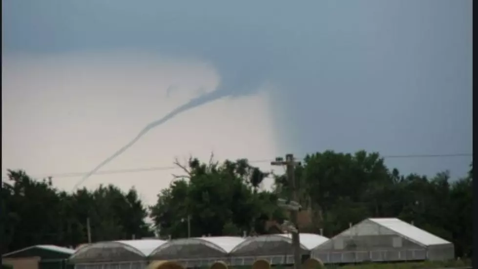
People were buzzing about reports of a 'tornado' that was seen, spout and all, Thursday afternoon. It was similar to this image, from the National Weather Service, weather.gov. except ours went straight up and down.
Around 3:40PM, the National Weather Service says it was detected around the "Richland area" while some people in Pasco reported seeing it.
It was a tornado like spout funnel with dark clouds above it. However, it was not really a true twister.

According to the NWS, it's what's called a "landspout." It's a tube of rotating air that stems from a strong whirlwind. A landspout is just like a waterspout, except it's on dry ground.
Think if it as a much larger version of dust devil. Here's now to tell the difference: Tornadoes start from the clouds and come down, while dust devils or landspouts eminate from the ground up. Tornadoes are obviously more angry looking as well.

Usually dust devils result from atmospheric disturbances or whirlwinds that spin across the ground, but eventually fade out within a few minutes. Landspouts are similar but involve more disturbed air.
But to the average person, they certainly look like a tornado. According to the NWS, the last official recorded landspout in the Tri-Cities occurred, oddly enough, in March of 2020, March 31st.
The reason we don't get tornadoes here (usually) is because we don't get the massive collisions of warm or hot air, with colder humidity like in the midwest. When hot and cold and wet air combine, along with wind, it creates thunderstorms, and conditions that cause disturbances that become tornadoes.
But this one made for some interesting conversation among Tri-Citians.
Here's a look at some of the far worse weather episodes in the U.S. over the years.
LOOK: The most expensive weather and climate disasters in recent decades
Gallery Credit: KATELYN LEBOFF
More From 870 AM KFLD


