New Study Updates Tsunami Effect on WA Coast (VIDEO)
The Washington State Department of Natural Resources along with the Washington Geological Survey division of DNR, have released a new report showing the effects a 9.0 magnitude earthquake and subsequent tsunami would have on the WA coast, Tacoma and Seattle. This report updates previous studies done on this scenario.

The Cascadia Subdivision Fault, which we've reported on before, is an increasingly watched massive 'crack' in the Pacific Ocean floor, approximately 65-70 miles off the coast. It's been monitored for a number of years; but over the last 2-3 has seen increasing activity.
Scientists and geologists say it's only a matter of time before it quakes, big time. Could be in a couple of years, could be in 10 or 20 or more. But when it goes, it's expected to produce at least a 9.0 on the Richter scale. The fault runs from the CA coast, up past Oregon and along the Washington coastline.
DNR has now released information about what such a quake and tsunami would do to Western Washington.
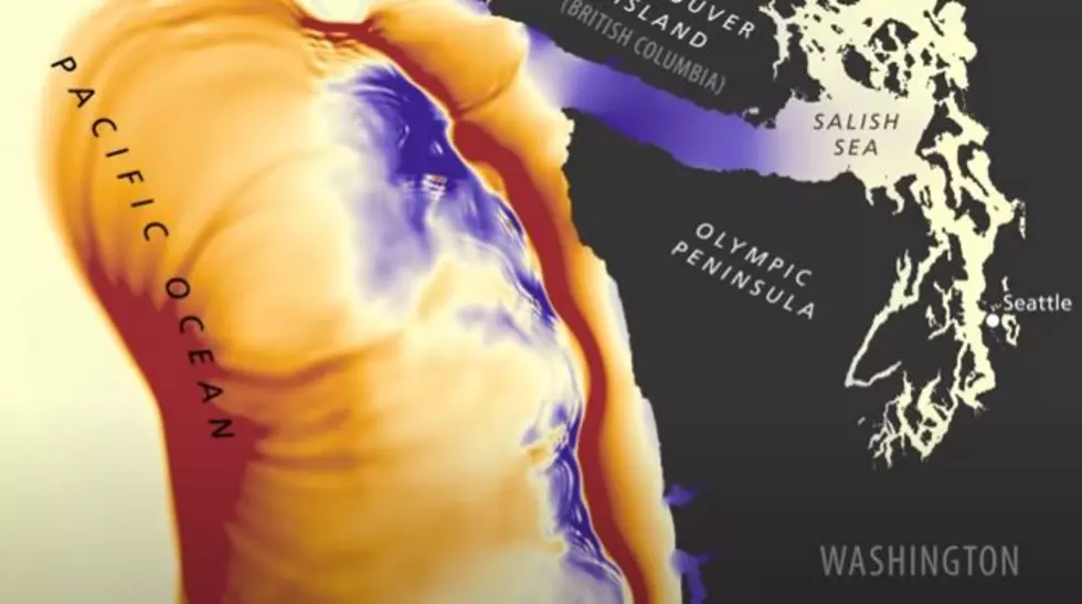
This video shows waves of at least ten feet or higher would slam into the WA Coast, and when churn down the Salish Sea, the large body of water north of Seattle and Tacoma. By the time it reaches these major metro centers, the Port of Tacoma would likely see water levels 3.5-4.0 feet higher, as would the coastal areas of Seattle.
It would take just over an hour for the first waves to hit Whidbey Island, the Vashon Island Ferry location would see a 13 foot wall of water. Continue reading to see video.
LOOK: The most expensive weather and climate disasters in recent decades
DNR Chief Hilary Franz says this reinforces the need for residents in these areas to know what to do in case this happens. DNR plans to encourage people to develop emergency plans to deal with this event, should it happen.
Here is the video, we started it at about :40 when the simulated quake hits.
More From 870 AM KFLD
